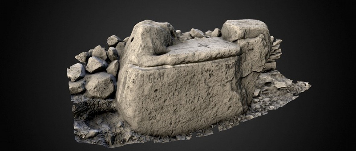

In recent years the development of technologies and techniques for the surface data capture of three-dimensional artefacts and monuments has allowed both geometrical and structural information to be documented. Several approaches have been developed, each of which addresses different circumstances and records different characteristics of the 3D artefact or monument. At present there is a wide range of 3D acquisition technologies, which can be generally classified into contact and non-contact systems. Contact systems are not popular in the Cultural Heritage (CH) domain as they require physical contact with potentially fragile artefacts and structures.
In contrast, non-contact systems have been used over the last decade in many CH digitisation projects with success. Non-contact systems are divided into active (thosewhich emit their own electromagnetic energy for surface detection) and passive (those which utilise ambient electromagnetic energy for surface detection).
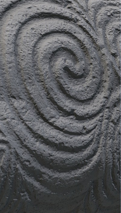
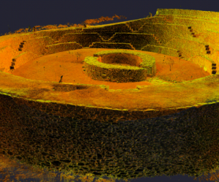
Active range-sensing instruments work without contact with the artefact and hence fulfil the requirement that recording devices will not potentially damage the artefact. In addition, their luminous intensity is limited to relatively small values and thus does not cause material damage (e.g. by bleaching pigments). These two properties make them particularly adapted for the applications in CH, where non-invasive and non-destructive analyses are crucial for the protection of heritage.
The capabilities of the different technologies vary in terms of several criteria which must be considered and balanced when formulating appropriate campaign strategies. These include:
 Resolution – the minimum quantitative distance between two consecutive measurements.
• Accuracy - what is the maximum level of recorded accuracy?
• Range – how close or far away can the device record and object?
• Sampling rate – the minimum time between two consecutive measurements?
• Cost – what is the expense of the equipment and software to purchase or lease?
• Operational environmental conditions – in what conditions will this method work, i.e. is a dark working environment required?
• Skill requirements – is extensive training required to carry out the data capture technique?
• Use – what the 3D data will be used for, i.e. scientific analysis or visualisation?
• Material – from what substance is the artefact/monument fabricated?
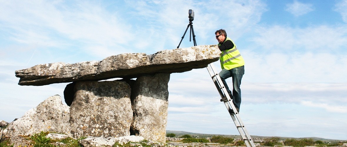
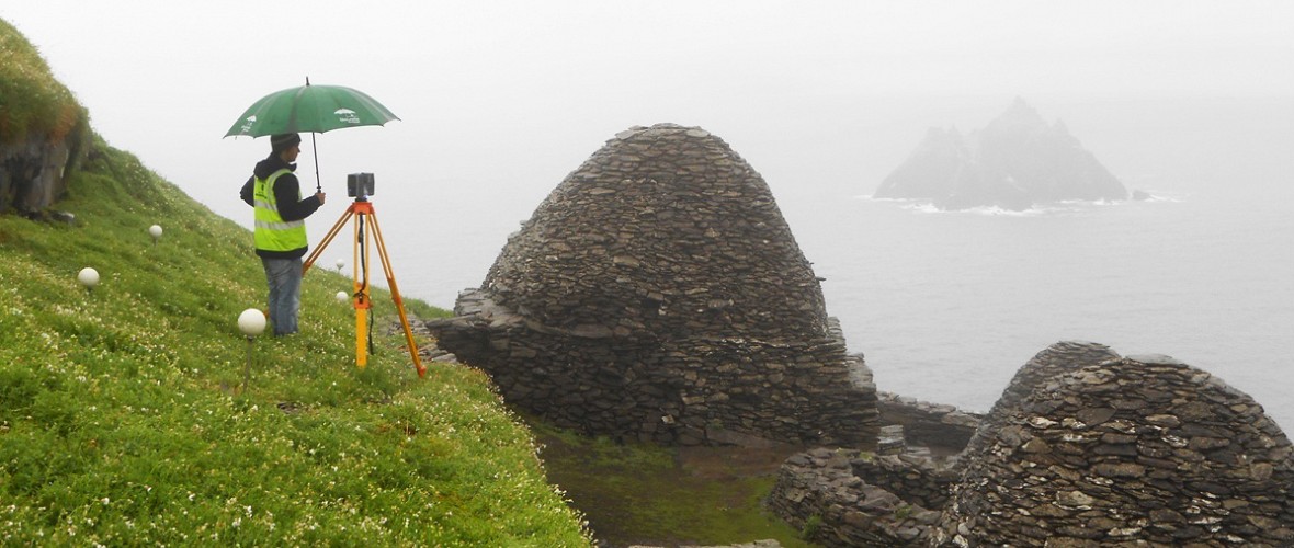
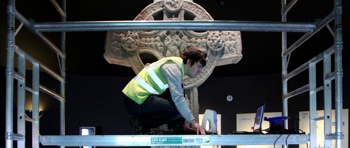
There are significant variations between the capabilities of different approaches. For example, triangulation techniques can produce greater accuracy than time-of-flight, but can only be used at relatively short range. Where great accuracy is a requirement, this can normally only be achieved with close access to the heritage object to be digitised (< 1m). If physical access to the artefact is difficult or requires the construction of special scaffolding, other constraints need consideration (e.g. using an alternative non-invasive technique). Alternatively, if physical access is impractical without unacceptable levels of invasive methods, then sensing from a greater distance maybe required utilising direct distance measurement techniques (TOF, Phase Deviation) leading to less accurate results. When selecting the appropriate methodology, consideration must also be given to the length of time available to carry out the data collection process and the relative speed of data capture of each technology.